
DeSoto State Park sits atop Lookout Mountain just northeast of Fort Payne, with color-blazed hiking trails, multi-use trails open to mountain bikes, waterfalls and CCC-era history. It's one of the easiest big days out from camp.
Know before you go
- Park address: 7104 DeSoto Parkway NE, Fort Payne, AL 35967
- Camping and general info: 1-800-760-4089
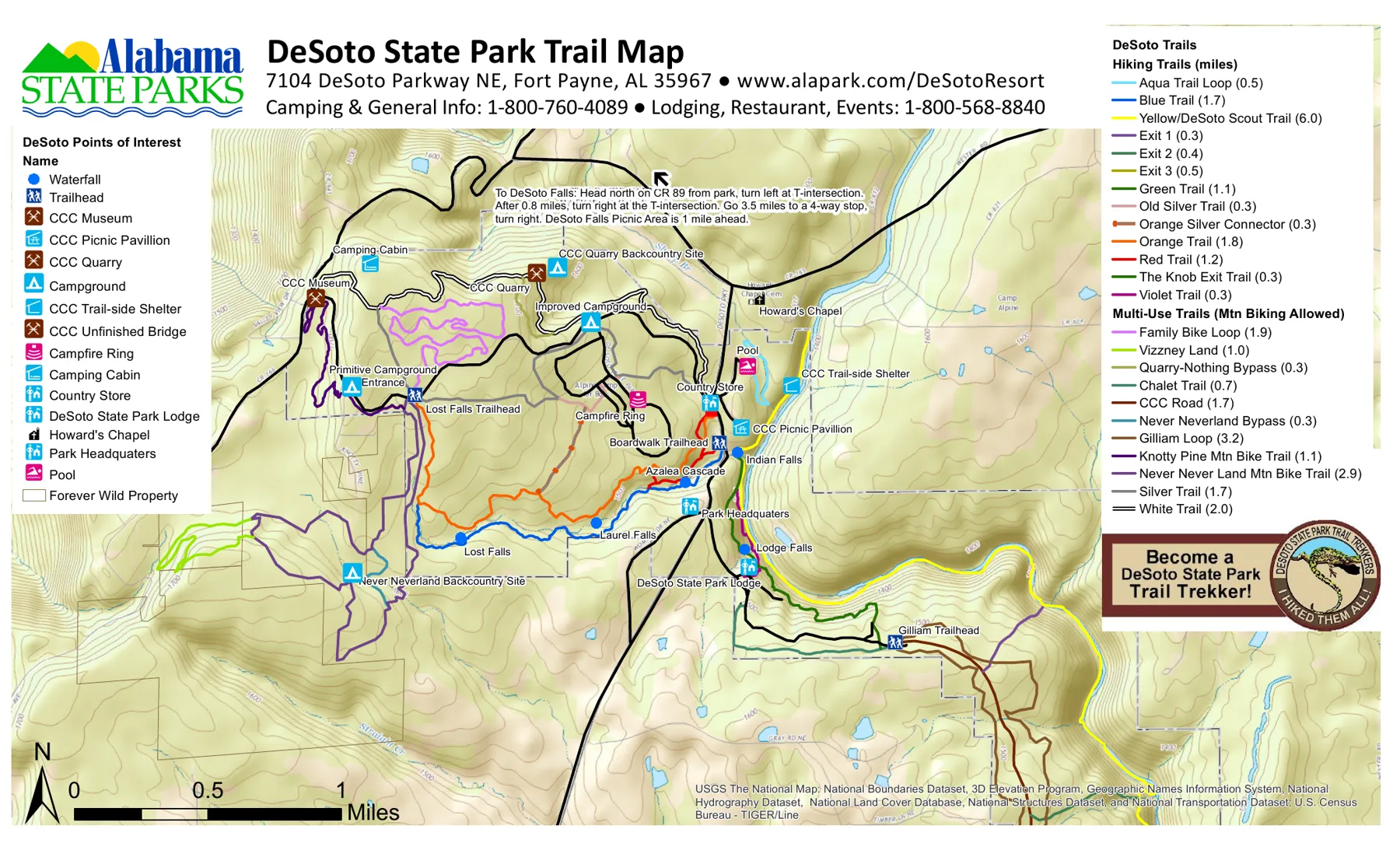
- Waterfalls on the trail map: Lost Falls, Laurel Falls, Indian Falls, Lodge Falls and Azalea Cascade.
- Mountain biking: multi-use trails include the Family Bike Loop (1.9 mi), Gilliam Loop (3.2 mi) and Never Never Land Mountain Bike Trail (2.9 mi).
- Longest hike: the Yellow/DeSoto Scout Trail runs 6 miles through the park along the West Fork of Little River.
Trail-by-trail lengths and difficulty are on Hiking Trails. Always check for closures with the park before you set out.
Directions from campOfficial park site